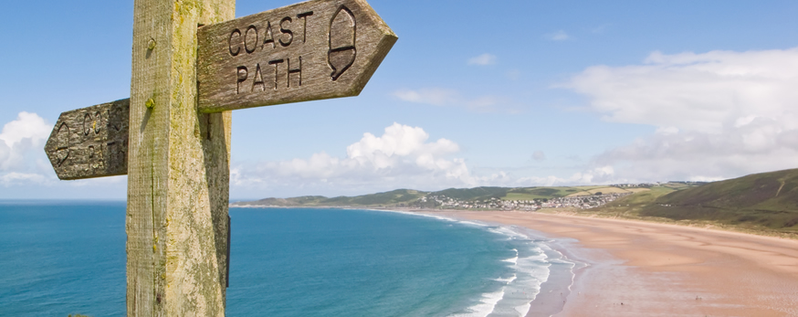
Walks
SALCOMBE TO SNAPES POINT:
Distance: 4.5 miles
Start Point: Shadycombe car park, Salcombe
Distance: 2.75 miles
Start Point: Snapes car park
Circular walk of moderate grade
Surfaced road; track; field footpaths, fairly even underfoot with occasional adverse camber
Not suitable for wheel chair users or pushchairs
Directions
- From car park entrance turn right down Gould Rd. Continue past Boat Park and along creek to Batson.
- At head of creek at Batson, turn right up lane signed as no through road.
- At the creek head by Snapes Manor turn left through kissing gate up footpath.
- Footpath leads around back of manor house and up old green lane.
- At the top turn right signed ‘Snapes Point’. Alternatively, for shorter walk, turn left and follow old carriageway up to National Trust car park. Turn left there along road, joining ‘Alternative’ route below.
- Follow carriageway downhill. As you near the creek, turn left following sign for Snapes Point. Walk up to viewpoint at knoll, and over brow to follow waymarker arrow along path which drops down to follow field edges above creek.
- After Tosnos Point, path climbs around back of small woodland. Just before gate out of field, turn left and follow fence line up hill then along contour.
- At fingerpost turn left signed ‘Car Park’ then right through next gate to National Trust car park.
- Here you can turn left and down the old carriageway and then left again to retrace your steps via the path around the back of Snapes Manor and along the road to Batson. Alternatively go straight on along road and turn left at Hall Cross, signed ‘Batson ¼ Salcombe ¾’.
- At Batson take the road back along the right bank of the creek past the lime kiln, and retrace your steps to car park and bus stop.
www.southdevonaonb.org.uk/explore/walks-trails/salcombe-to-snapes-point
EAST PORTLEMOUTH TO GARA ROCK
Distance: 3.75 miles
Start point: Ferry Pier, Salcombe
Circular walk
Coastal footpath, uneven and rocky in places; surfaced road; green lane; field footpath.
Not suitable for wheel chair users or pushchairs
Just over half-way there is the Gara Rock restaurant – perfect for a refreshing drink, lunch or slice of cake to boost those energy levels!
Directions
- From spring to autumn the ferry to East Portlemouth runs from the ferry pier, 200m beyond Whitestrand along Fore Street.
- At the top of the steps from the jetty turn right along the road.
- At Mill Bay bear right, signed ‘Gara Rock 2.5 miles’. Ignore both a left turn signed ‘Top Path to Gara Rock’ and a left fork for the beach, and follow the acorn waymarkers along the coast path.
- When you reach the ‘Gara Rock’ waymarker, bear left and head up to the small round white lookout post. Pass in front of the lookout, through the gate, and turn left at the fingerpost, signed ‘Mill Bay 1.25 miles’.
- Follow the lane leading inland. After 200m turn left onto public footpath.
- Cross straight over the field ahead. Where you drop down to a track, cross over and down bridleway, following blue waymarker arrows.
- At Mill Bay turn right and retrace your steps along the road to the jetty, and the ferry back to Salcombe.
www.southdevonaonb.org.uk/explore/walks-trails/east-portlemouth-to-gara-rock
SALCOMBE TO BOLT HEAD
Distance: 2.75 miles
Start Point: just past South Sands
Distance: 3.25 miles extended route
Start Point: centre of Salcombe
Moderate
Coastal footpath, uneven and rocky in places; surfaced road; field footpath.
Not suitable for wheel chair users or pushchairs
Directions
- The ferry for South Sands leaves from Whitestrand Pontoon in the centre of Salcombe. To get there from the car park and bus stop at Shadycombe, follow pedestrian signs into the town centre, turn left along Fore Street, and left again after 100m to the waterfront at Whitestrand.
- From South Sands as you disembark from the ferry turn left, or from the Tides Reach car park turn right, along the road which curves uphill.
- Continue straight on past the National Trust hut. Follow sign for YHA and Overbecks along winding drive uphill.
- Right in front of gates to Overbecks, turn right up footpath past sign for Tor Woods, Sharp Tor and Bolt Head.
- At the next fingerpost turn left up steps signed for Sharp Tor, Starehole and Bolt Head.
- Continue along footpath past Sharp Tor – marked by compass on plinth. Go straight on at next fingerpost signed for Starehole and Bolt Head to drop down into valley.
- Cross the stream at the bottom. Turn left here down the valley and left again onto the coast path.
- Alternatively, for an extended walk taking in Bolt Head itself, go straight on after crossing the stream up the steep path opposite and along the wall.
- At the fingerpost take 2nd path left signed ‘Coast Path Salcombe 2 3/4m’. This path drops along flank of ridge.
- Bear round to the left at the tip of the ridge to follow the coast path. You rejoin the shorter route at the bottom of the next dip at Starehole Bay.
- Now simply follow the coast path back into the estuary mouth and through the woods. Bear right where you meet the road to return to South Sands.
www.southdevonaonb.org.uk/explore/walks-trails/salcombe-to-bolt-head
HOPE COVE TO BOLBERRY DOWN
Distance: 5 miles
Start Point: Outer Hope Car Park
Moderate
Coastal footpath with some uneven ground; surfaced road; green lane; fairly even country footpath. Should be pointed out there are 4 stiles and 1 flight of steps. There are two ascents on the walk, though the climbing is long and steady rather than very steep.
Not suitable for wheel chair users or pushchairs
Directions
- Turn left out of car park and follow the lane through the village. This becomes a path and then a road again down into Inner Hope.
- By the slipway, follow the coast path up the steps. Follow the waymarked path, which snakes around Bolt Tail, and along the cliffs.
- At Bolberry Down turn down the lane. At the next T-junction, turn left, then just around the corner fork right.
- Drop down the hill, then up the other side of the dip, and turn left onto the green lane signed ‘Sweethearts Lane’.
- At the next junction turn left, signed ‘Public Footpath Galmpton 1/2 mile’. This path cuts off to the right by the gateway to Higher Barton, signed ‘Public Footpath, Galmpton 3/4 mile and runs up across one small field and right along the field margin of the next.
- Though gate and turn left over the stone stile by the tall waymarker post and follow the field edge footpath back to Hope.
- Cross the road and follow the path down steps by the side of St Clements Church, then turn right and return through Hope to the car park.
www.southdevonaonb.org.uk/explore/walks-trails/hope-cove-to-bolberry-down